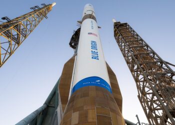
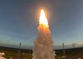
Europe’s Ariane 6 has placed the Copernicus Sentinel-1D satellite into orbit, strengthening the program’s all-weather radar imaging and maritime tracking capacity. Liftoff occurred on 4 November 2025 at 22:03 CET (18:03 local time) from Europe’s Spaceport in French Guiana. The mission, designated VA265, advances deployment of Europe’s heavy-lift launcher while expanding global synthetic aperture radar coverage.
Mission Highlights
- Launch vehicle and site: Ariane 6 from Europe’s Spaceport, French Guiana
- Time and date: 4 November 2025, 22:03 CET (18:03 local time)
- Flight designation: VA265
- Constellation: Sentinel-1D will operate with Sentinel-1C, flying in the same orbit but 180 degrees apart to optimize global coverage and data delivery
- Instruments: C-band SAR for high-resolution imaging, plus an onboard Automatic Identification System (AIS) receiver to enhance ship detection and tracking
For full launch coverage and official mission details, see the ESA launch coverage.
Payload and Capabilities
Sentinel-1D carries a C-band synthetic aperture radar that acquires high-resolution imagery of Earth’s surface in all weather, day and night. This capability is designed for consistent monitoring regardless of cloud cover or lighting conditions. The satellite also hosts an AIS payload that receives signals broadcast by vessels, improving the accuracy and frequency of maritime tracking data when combined with SAR imaging.
Together, SAR and AIS support applications that benefit from both surface imaging and ship identification, including wide-area situational awareness in busy sea lanes and improved detection of vessels under challenging weather or illumination conditions.
Constellation Operations
Operating 180 degrees apart from Sentinel-1C, Sentinel-1D is expected to increase global revisit frequency and reduce data latency for users. The configuration is intended to enhance the continuity and resilience of Copernicus radar observations while facilitating more frequent AIS observations once Sentinel-1D completes commissioning and becomes fully operational.
Applications and Impact
- Disaster response: Rapid mapping of floods, landslides, earthquakes and volcanic activity, enabling timely assessments
- Maritime monitoring: Improved ship detection and tracking, sea-ice charting, and observation of coastal processes
- Environmental oversight: Monitoring of oil spills, deforestation, land deformation and infrastructure stability
- Climate services: Long-term records of sea ice, snow, wetlands and surface change to support climate analysis
What Happens Next
Following launch, Sentinel-1D will undergo a commissioning and calibration phase before entering routine service. As operations ramp up, the mission is expected to deliver more frequent radar imaging and AIS sampling, reinforcing data continuity for Copernicus users in emergency management, environmental monitoring and maritime safety.