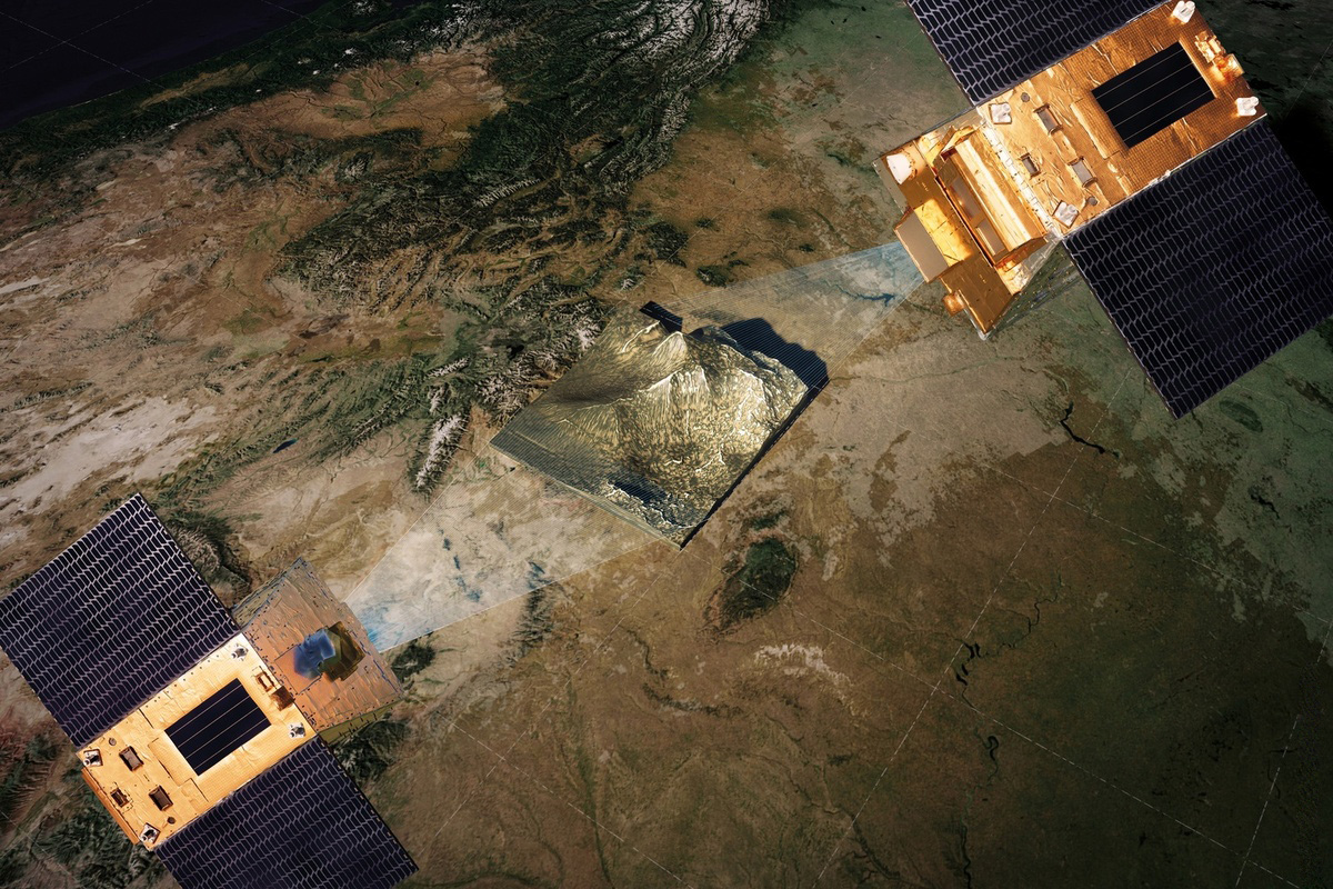
CO3D, a joint mission from CNES and Airbus Defence and Space, is designed to generate global, high-resolution 3D land maps using stereo imaging from a four-satellite constellation. Operating in synchronized pairs, the spacecraft will capture the same area from slightly different angles to reconstruct precise digital elevation and surface models at 50-centimetre resolution.
How the constellation captures depth
The four small optical satellites fly in coordinated pairs to acquire simultaneous stereo imagery. This approach delivers detailed topography and object-level context across built and natural landscapes. Multispectral data in the visible and near-infrared bands help discriminate land cover and vegetation while enhancing 3D reconstruction quality.
- Paired acquisitions enable consistent, large-scale stereo coverage.
- Ground sampling distance of 50 cm supports object-level mapping of features such as buildings, trees and hedgerows.
- Visible and near-infrared bands support vegetation analysis and land-cover differentiation.
Key Earth and security applications
- Hydrology and flood risk: Catchment elevation models and drainage network mapping to support early warning and adaptation planning.
- Cryosphere monitoring: Regular updates for glacier extent, flow and mass-change assessments, with integration pathways alongside existing observatories.
- Forests and agriculture: Tree-height and volume estimation, biomass indicators, and field-scale features important for biodiversity and land management.
- Urban planning: Very detailed 3D city models to analyze heat islands, wind flow, noise propagation and building energy performance.
- Coastal mapping: Littoral topography and bathymetry to 10–15 metres in suitable water clarity, supporting shoreline-change analysis and coastal resilience.
- Civil protection and mining: Monitoring of terrain change, infrastructure exposure and operational safety.
- Defence and security: Dual-use terrain products for low-altitude mission planning, mobility analysis and amphibious operations.
Operations, access and scale
- Public–private partnership: Funded by CNES (40%) and Airbus Defence and Space (60%). Airbus will serve as commercial operator following an 18‑month demonstration phase.
- Coverage: Target of 125 million sq.km of land surfaces mapped in 3D over three years, including near-shore coastal waters where conditions permit.
- National access: CNES will make 600,000 sq.km of imagery available annually free of charge to French institutional partners.
- Throughput and processing: Approximately 6,000 terabytes of data processed with cloud-based, automated pipelines for stereo reconstruction and product generation.
- Acquisition efficiency: High-cadence weather updates every 15 minutes optimize tasking to reduce cloud-related data loss.
With global stereo coverage, metre‑scale elevation fidelity and multispectral context, CO3D is positioned to accelerate climate adaptation, resilient infrastructure planning and operational terrain awareness across civil and defence domains. Source: CNES