Artificial intelligence models developed under the European Space Agency’s ESA Phi-lab Challenges are moving toward operational use for post-earthquake damage assessment, following the conclusion of the AI for Earthquake Response Challenge and the start of a CNES-led evaluation within the International Charter ‘Space and Major Disasters’ rotation.
Key outcomes from the ESA AI challenge
Four teams were recognized for top performance in automating satellite-based building damage detection after earthquakes: TelePIX (Republic of Korea), Datalayer (Belgium), DisasterM3 (Japan) and Thales Services Numériques (France). The awards were presented during the Charter’s 54th Board Meeting in Strasbourg, coinciding with the French space agency CNES taking leadership of the Charter for the next six months.
The competition attracted 143 participants from 40 countries and tested end-to-end approaches to accelerate reliable post-disaster mapping from high-resolution Earth observation data.
Data, methods and performance
Participants trained models to distinguish damaged from undamaged buildings using one of the largest curated datasets for earthquake response:
- Over 200 high-resolution images across five major earthquakes and 13 sites
- Approximately 475 GB of multisensor data with variable resolutions and complex co-registration
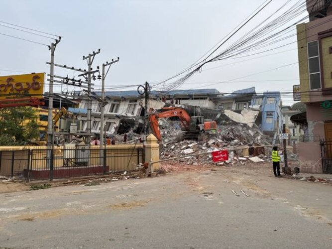
- Severe class imbalance typical of real events, including a Mandalay, Myanmar test case where roughly 0.2% of nearly half a million buildings were damaged
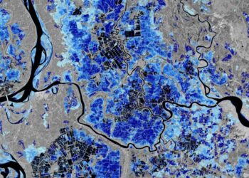
European finalists highlighted complementary strategies: Datalayer scaled cloud-based machine learning pipelines to process the dataset efficiently, while Thales Services Numériques applied deep-learning and trustworthy-AI methods adapted from aerospace to pinpoint structural damage. TelePIX’s model outputs over Mandalay illustrated how AI can flag likely damage at city scale, and DisasterM3 contributed high-performing techniques suited to heterogeneous imagery.
International collaboration and infrastructure
The challenge drew on the International Charter’s operational archives and a global virtual constellation, including Pleiades (CNES/Airbus), WorldView and GeoEye (USGS/Maxar), KOMPSAT-3 (KARI), BlackSky, and Gaofen-2 (CNSA). The dataset’s diversity was designed to reflect real-world emergency conditions and sensor mix.
The Luxembourg Institute of Science and Technology (LIST) and ACRI-ST (France) coordinated the competition and scientific oversight. Terradue (Italy), developer of the ESA Charter Mapper, enabled global access to the dataset through ESA Phi-lab’s Earth Observation Training Data Lab, ensuring a common development environment for all teams.
Path to operations under CNES leadership
CNES, as operator of the Pleiades constellation and current lead agency of the Charter, has initiated a post-challenge evaluation to determine how the best-performing models can be integrated into damage-mapping workflows that support rapid disaster response. The objective is to reduce time from satellite acquisition to actionable building damage maps while maintaining reliability across sensors, geographies and event scales.
- Benchmark the top models on additional Charter-relevant scenarios
- Assess interoperability with existing mapping chains and the ESA Charter Mapper
- Validate outputs against ground truth and operational partner feedback
- Define pathways for routine activation during Charter calls
Why it matters for the space sector
The initiative underscores how AI for Earth observation is transitioning from research to operations. For space agencies, operators and analytics providers, the work demonstrates:
- Scalable processing of large, heterogeneous VHR imagery under time constraints
- Robustness requirements for safety-critical mapping products
- Value of multi-agency data-sharing frameworks to assemble diverse training corpora
- Opportunities to integrate trustworthy-AI practices into operational EO services
With CNES guiding operational evaluation and ESA Phi-lab continuing to catalyze innovation, the Charter’s network of 17 space agencies is positioned to leverage AI-enhanced damage mapping in future emergency activations.
Source: European Space Agency