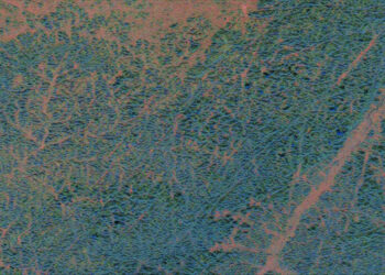
NASA, the U.S. Geological Survey (USGS), and the European Space Agency (ESA) have released Harmonized Landsat and Sentinel-2 (HLS) v2.0, unifying Landsat 8/9 and Sentinel‑2A/B—and now Sentinel‑2C—into a single, consistent surface reflectance record. The upgrade delivers near-global 30 m land coverage from 2013 onward and a median revisit of about 1.6 days (in 2022 with Landsat 8/9 and Sentinel‑2A/B), tightening observational gaps and accelerating change detection for science and operational users.
What’s new in HLS v2.0
- Coverage and resolution: Near-global land coverage (excluding Antarctica) at 30 m resolution, retrospectively available to 2013.
- Cadence: Median global repeat of ~1.6 days in 2022; the addition of Sentinel‑2C further increases observation frequency.
- Harmonization algorithms: Improved atmospheric correction, cloud masking, and BRDF normalization make Landsat and Sentinel‑2 data more interchangeable.
- Access and latency: Data are available via NASA Earthdata and Google Earth Engine, with a program goal of a six-hour low‑latency product to speed delivery to end users.
- Derived analytics: Expanded HLS-based vegetation indices broaden ready-to-use agronomic and environmental indicators.
Why this matters
The tighter cadence and harmonized calibration enable more reliable multi-sensor time series for disaster response, crop and rangeland management, water resources, and urban change detection. Agencies and practitioners are leveraging HLS for field‑scale crop emergence mapping, drought‑era grazing decisions, cover‑crop adoption tracking in the Chesapeake Bay watershed, and post‑storm damage assessments, including aid prioritization after Hurricane Helene in 2024.
Operational products built on HLS
HLS v2.0 underpins new operational monitoring tools, notably NASA/JPL’s OPERA portfolio:
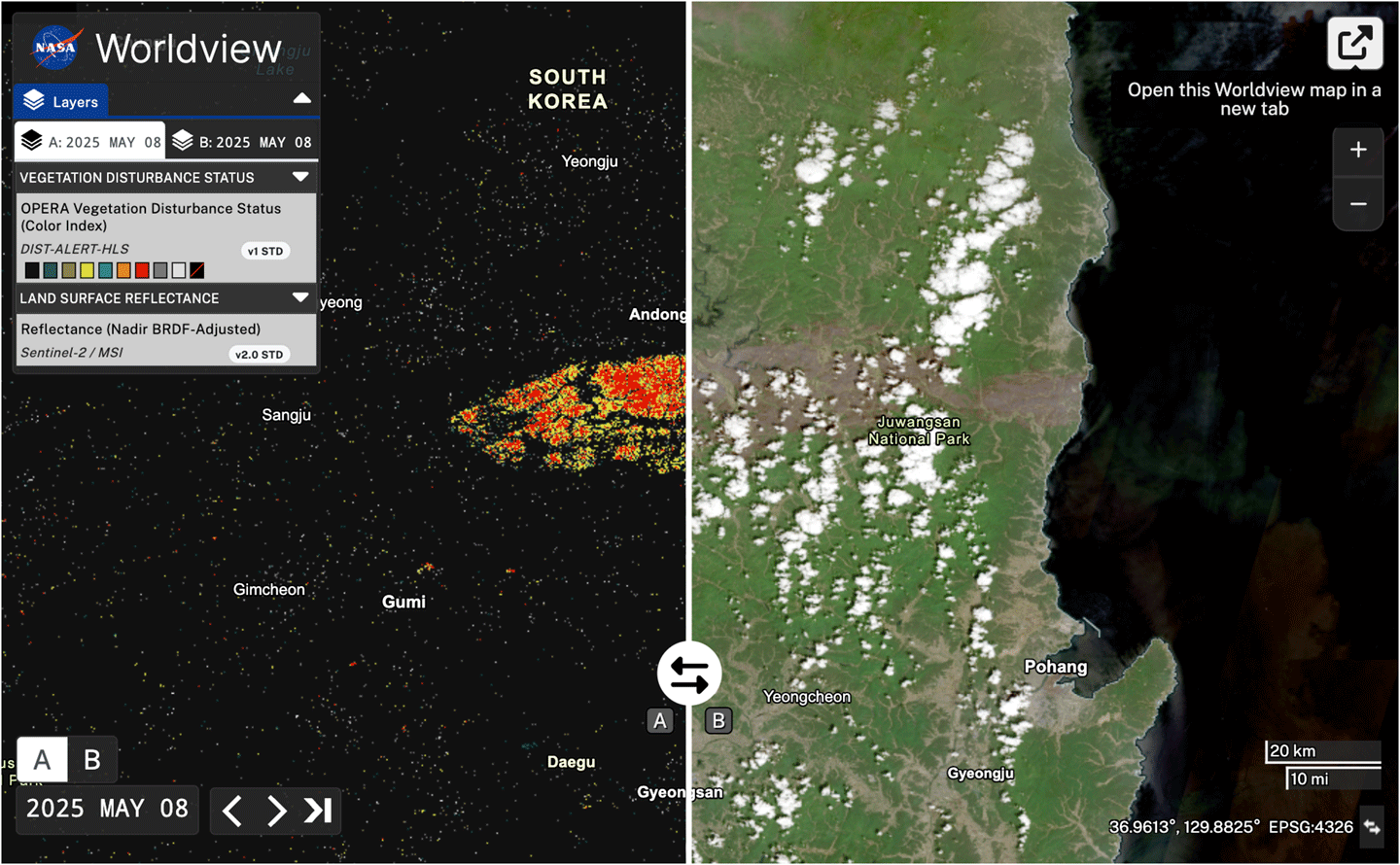
- DIST-ALERT: A global land disturbance system that flags anomalies such as fire, flood, logging, drought impacts, landslides, agricultural expansion, and rapid urbanization. It uses a rolling baseline—comparing each pixel against the same 31‑day window over the previous three years—to detect both vegetation loss and broader spectral anomalies. Results are posted to LP DAAC within hours of new HLS availability, improving timeliness in cloudy regions and refining estimates of disturbance start and end dates. Recent events, including 2025 wildfire burn scars in South Korea, illustrate its rapid-change sensitivity.
- DSWx (Dynamic Surface Water eXtent): A global surface‑water mapping suite that tracks lakes, rivers, inundation, and floods from HLS inputs. Coupled with tools such as FwDET for floodwater depth estimation, DSWx has detailed recent large‑scale flooding in southern Brazil, providing depth context for emergency response and recovery planning.
Interagency roadmap and collaboration
HLS originated from an effort to create a “virtual constellation” for land imaging by harmonizing Landsat and Sentinel‑2. The Satellite Needs Working Group (SNWG) helped transition HLS from research to operations beginning in 2016, later requesting added vegetation indices (2020) and lower latency (2022). OPERA at NASA/JPL, working with the University of Maryland’s GLAD lab, is translating these capabilities into global, near‑real‑time land‑change and surface‑water services to meet federal agency needs.
What’s next
The HLS team is advancing cloud masking, refining harmonization across sensors, expanding indices, and developing a low‑latency HLS surface reflectance stream. Future Sentinel and Landsat missions will further increase revisit rates and spectral robustness, strengthening the backbone for operational Earth observation, environmental compliance, and disaster risk management.
Source: NASA: Harmonized Landsat and Sentinel-2 — Collaboration Drives Innovation