A new U.S.-European ocean altimetry satellite, Sentinel-6B, is set to launch in November, aiming to sharpen marine forecasts and enhance shipping safety with precise, near-real-time measurements of sea surface height, significant wave height, and surface wind speed. The mission is led by NASA and ESA within the Sentinel-6/Jason-CS Continuity of Service program and will ultimately assume primary duties from its twin, Sentinel-6 Michael Freilich, launched in 2020. Mission details are available via this NASA mission update.
What Sentinel-6B will measure
Sentinel-6B carries a radar altimeter supported by microwave radiometry and radio occultation sensors to deliver high-accuracy ocean observations that feed global weather and ocean models.
- Sea surface height and anomalies for mapping ocean topography and large currents
- Significant wave height for characterizing sea state
- Surface wind speed to inform marine weather analysis
- Derived current positions, including boundary shifts of systems such as the Gulf Stream
Why it matters for shipping and marine forecasting
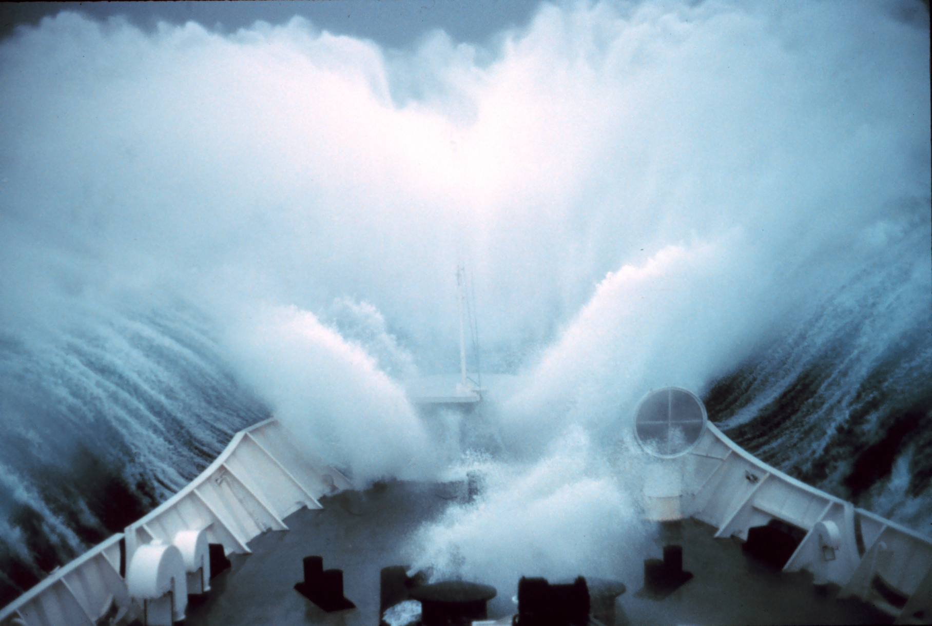
Because most global trade moves by sea, timely and accurate ocean forecasts are critical for routing and risk reduction. Interactions between strong currents and incoming waves can rapidly generate hazardous conditions, even when winds are moderate. By expanding spatial coverage over data-sparse regions, Sentinel-6B’s altimetry helps forecasters identify evolving sea states and current boundaries that influence vessel stability, fuel consumption, and cargo security.
- Improved route planning to avoid rough seas and current-wave interactions
- Enhanced warnings for high winds and large waves along major shipping lanes
- More consistent depiction of mesoscale features that affect voyage times and safety margins
Extending the sea-level record
Sentinel-6B will extend a continuous, cross-calibrated sea-level record that spans more than three decades, tracing back to the early 1990s. Flying in the same reference orbit as its predecessors enables centimeter-level accuracy and long-term stability with minimal drift. The dataset serves as the benchmark for sea-level measurements from space, providing a baseline for climate trend analysis and a standard against which other missions are compared. This continuity supports both operational forecasting and long-term assessments of ocean change.
Partners, instruments, and roles
Sentinel-6/Jason-CS is a collaboration that combines operational and research expertise across agencies:
- Agencies: NASA, ESA, the European Union, EUMETSAT, and NOAA, with technical support from CNES
- Instruments from JPL: Advanced Microwave Radiometer, GNSS Radio Occultation, and Laser Retroreflector Array
- NASA contributions: launch services, ground systems for instrument operations, science data processors for two instruments, and support for U.S. participants on international science teams
Timeline and next steps
After launch and commissioning, Sentinel-6B is expected to take over the primary mission from Sentinel-6 Michael Freilich, maintaining continuity for operational centers that assimilate altimetry into ocean and weather prediction systems. The expanded coverage and consistency are designed to improve marine hazard mapping, refine current and eddy tracking, and support decision-making across shipping, fisheries, and coastal monitoring.
For full context and updates, see the NASA mission update.